552 ADAMS ST
Owner Information
FIVE HUNDRED FIFTY-TWO ADAMS STREET LLC
552 ADAMS ST
MILTON, MA 02186


Property Details
552 ADAMS ST is classified as a Eating and Drinking Establishments - restaurants, diners, fast food establishments, bars, nightclubs (Restaurant).
The primary structure on this property was built in 1971. There are 8317ft2 of built area within this property. There is 8317ft2 of residential/living space within this property.
552 ADAMS ST is valued at 2349000. The land is valued at 800300 and the structures are valued at 1524500. There is an additional valuation of 24200 on this property.
This property is in Zone B. Confirm with local Zoning Board authorities to ensure there are no overlays or other easements on this property.
The most recent deed for 552 ADAMS ST is recorded at the local registrar in Book 766, Page 154. 552 ADAMS ST was last sold on 1998-09-29 for 690000.
Assessment data from fiscal year 2021.
Flood Data
According to the FEMA National Flood Hazard Layer, this property does not appear to be in a flood zone. It may also be in an area not yet reviewed. Nonetheless, confirm this information prior to taking any action.
To view the flood hazards around this property, create a FEMA "Firmette" Map of the area around 552 ADAMS ST.
Broadband Internet Providers
| Provider | Type | Bandwidth (mbps) | |
|---|---|---|---|
| GCI Communication Corp. | Satellite | 0 | 0 |
| VSAT Systems, LLC. | Satellite | 2 | 1 |
| Viasat Inc | Satellite | 100 | 3 |
| HughesNet | Satellite | 25 | 3 |
| Comcast | Cable | 1000 | 35 |
| Verizon New England Inc. | DSL | 7 | 0 |
| RCN | Cable | 500 | 20 |
Broadband service provider data from December 2020.
Adjacent Properties
- 556 ADAMS ST
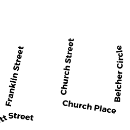
Eating and Drinking Establishments - restaurants, diners, fast food establishments, bars, nightclubs owned by FALCONI PROPERTIES LLC - 21 FRANKLIN ST
Two-Family Residential owned by GIGLIO FRANK TRUSTEE - 22 CHURCH ST
Single Family Residential owned by DUFF JAMES W - 22 CHURCH ST
Two-Family Residential owned by DUFF JAMES W - 20 CHURCH ST
Single Family Residential owned by HYNES RICHARD & KATHLEEN T - 0 CHURCH ST
Parking Lots - a commercial open parking lot for motor vehicles owned by FALCONI PROPERTIES LLC